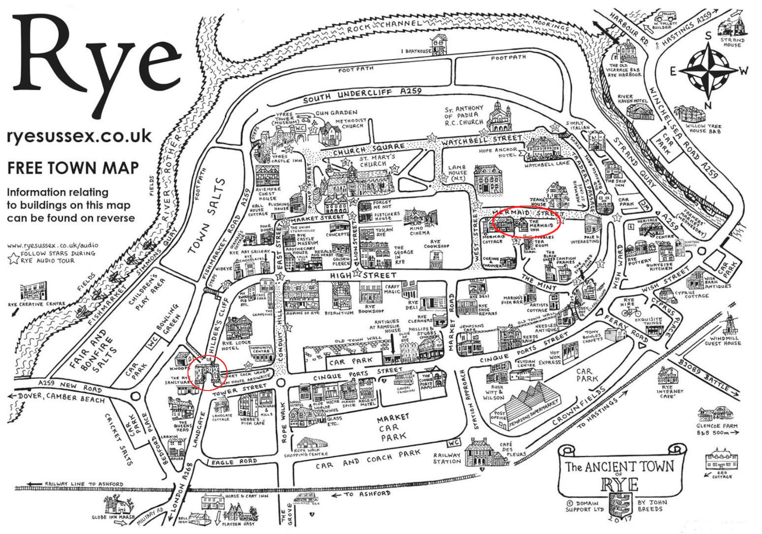
The ancient town of Rye

I 've drawn an oval around the Mermaid Inn and a circle around the Landgate. The compass directions are upside down on the map, so south (pointing to the English Channel) is at the top, east is to the left. We drove in from Folkestone from the east on the A259, making a complete circle around the town, eventually going through the Landgate to get to the Mermaid Inn. Snaking around the one-way streets of Rye wasn't the original plan: I missed the turn for Mermaid Street on the west end of town. The Benson Lookout is through the Landgate on Childer's Cliff, at the end where the road bends around to High Street (tiny star 11 on the map). St. Mary's Church is at the end of Lion Street, heading south from the middle of High Street. Lamb House is due west from St. Mary's, and around the corner on West Street is the top of Mermaid Street.
Before the 16th century, Rye was surrounded on three sides by the English Channel. (Note the rivers on the east, south, and west around the town.) This meant that the only way into Rye was from the north through the Landgate. Because of shingle drift over the centuries, the coastal town of Rye is now 2 miles from the Channel. What used to be harbor is now pasture. (See view from lookout picture—ewe won't regret it.)